


UAV Forecast Drone Weather Map
4.43.00 Reviews
App Specs
- Version
- 2.0
- Updated On
- License
- Free
- Downloads
- 10,000+
- Developer
- MONIQ TAP., CO LTD
- Categories
- Weather
- Platform
- Android
Screenshots
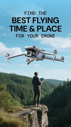
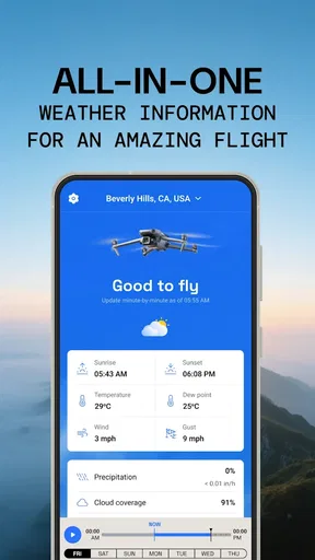
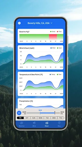
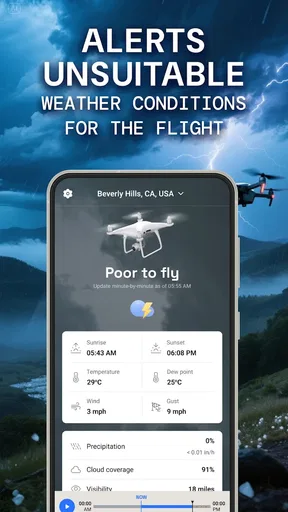
 Analysis by AppCompare
I treat drone weather checks differently from ordinary forecasts: a pleasant day for a walk does not automatically mean a comfortable flight. Wind near the ground, changing conditions along a route, and the chance of losing a reliable signal can all affect whether a planned outing makes sense. UAV Forecast Drone Weather Map is built around that decision, putting flying conditions and a map in the same weather-focused app rather than making me translate a general forecast on my own.
A forecast shaped around a flight decision
The useful idea here is not simply showing weather; it is presenting weather as information a pilot can use before unpacking a drone. When I’m deciding whether to bring it along, I want to check conditions at the intended place and time, not just see a broad label such as “sunny.” The app’s focus on UAV flying makes that kind of check its central purpose.
That focus is particularly handy when a forecast looks mixed. A day can be bright and still feel unsuitable for flying, while a cloudy period is not automatically a reason to cancel. Rather than treating a general weather icon as a verdict, I can use a drone-oriented forecast as one input in a more careful go-or-wait decision. It helps turn a vague weather check into a flight-planning habit.
There is a practical distinction worth keeping in mind: a forecast can support a decision, but it cannot promise what conditions will be at the exact spot where a drone is operating. I would still pay attention to what I see and feel on arrival and follow the guidance for my aircraft and location. For me, the app is most valuable as preparation, not as permission to fly regardless of what the sky or surroundings are doing.
How I’d use it before setting off
My first check would be at home, while I still have time to change plans. I’d look up the intended flying area, review the forecast for the period I expect to be there, and decide whether the trip is worth making. If the outlook is uncertain, I’d treat that as a reason to stay flexible rather than squeeze a flight into a narrow window simply because I already packed.
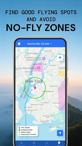
The map is useful when a day out involves more than one possible launch area. I can compare locations instead of assuming the nearest park or open space will be the best choice. That doesn’t replace checking local rules, access, obstacles, or people on the ground; it simply makes the weather part of the comparison easier to organize.
I’d also make a second check when I arrive. Forecasts are planning aids, and conditions can differ from what a screen suggested earlier. Looking again before launch gives me a chance to reconsider if the wind feels uncomfortable or the sky has changed. That small pause is more useful than treating any single forecast view as a guarantee.
Worth Reading Before You Choose

Switching to Android Auto Means Rethinking Your Driving Routine

Google Calendar Makes a Crowded Week Easier to Manage

Baby Panda World Brings Quick Play to Modern Phones, but Its Game Library Feels Busy

ESPN’s Live Game View Makes Following Close Games Easier

QuizzLand Review: A Good Fit for Short Trivia Breaks, Not Every Player

Basketball Stars: Multiplayer Is Fast, but Can It Recover When Matches Go Wrong?
Getting to Know UAV Forecast
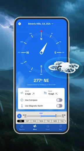
So what’s the deal with this app? Well, UAV Forecast is like that friend who always knows what the weather is going to do next. It offers detailed weather forecasts for drone pilots, including wind speed, temperature, and even satellite visibility. This isn’t just a weather app; it’s a specialized tool designed to help you make sure your drone flights are safe and smooth.
Features You’ll Love
First off, the interface is super user-friendly. I’m all about simplicity, and thankfully, this app doesn’t bombard you with unnecessary information. Everything is neatly laid out, making it easy to get the info you need at a glance. The wind speed and direction are right up front, which is crucial for any drone pilot.
The app also provides forecasts for the next 24 hours. This means you can plan your flights ahead of time rather than making last-minute decisions. It’s like having foresight into the future, which is pretty cool if you ask me.
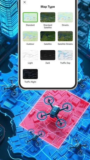
Another nifty feature is the map overlay. You can see the weather conditions in real time on a map, which is incredibly useful if you’re planning to fly in different locations. Plus, the satellite visibility feature lets you know when GPS conditions are optimal for flying.
Putting the map and forecast to work
A realistic use for me would be a weekend trip where I’m choosing between two places to fly. One might be more convenient, but if its forecast looks less promising for the time I can visit, I can weigh the other location before driving out. I would check the map and forecast together, then make the final call after seeing the conditions on site. That workflow is more helpful than checking only the weather at home and assuming it applies everywhere I might go.
The map also encourages a useful habit: check the conditions for the actual destination, not just the town name or your current location. A forecast tied to the wrong place can create false confidence. Before leaving, I’d confirm that the selected point matches the intended flying area, then revisit it if the plan changes. This is a simple step, but it matters when a day includes several stops or a last-minute change of scenery.
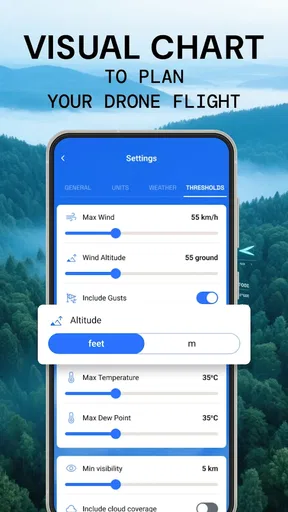
Wind information deserves special attention. A number on a screen is easier to interpret when I compare it with what my own drone can handle and the way I intend to fly. A short, cautious flight close to a safe landing area is not the same decision as a longer outing in a more exposed place. I’d use the forecast as a prompt to think about that difference rather than searching for one universal “safe” reading.
The satellite-visibility information is another reason this is more specialized than a standard weather app. It gives a pilot a condition to consider alongside wind and temperature, particularly when planning a flight where dependable positioning matters. I wouldn’t treat it as a substitute for understanding the aircraft’s own status or surroundings, but it helps keep the planning discussion focused on flying rather than just whether it might rain.
Where it differs from an ordinary weather app
A mainstream weather app is usually the better choice when I only need a quick answer about rain, temperature, or what to wear. It is familiar and broad, and it may already cover the everyday questions I have. This app makes more sense when the question is specifically whether conditions are worth considering for a UAV flight, because its wind-oriented presentation, satellite visibility, and map-based planning speak to that purpose.
The trade-off is that a drone-focused forecast is not a complete substitute for local judgment. It cannot tell me whether a particular launch point is crowded, whether a tree line creates turbulence, or whether I’m allowed to fly there. Those are separate checks. I’d pair the app with common sense and the rules that apply to the location, rather than expecting a weather tool to settle every part of a flight plan.
It also helps to decide in advance what would make me postpone. If I wait until I am already at the spot, I may be tempted to fly because I have made the effort to get there. Checking earlier lets me set a personal limit while I’m still comfortable changing plans. For a beginner, that can be a better use of the forecast than trying to interpret every detail at the last minute.
Why You Should Give It a Spin
Okay, let's talk about why you absolutely need to have this app if you’re into drones. Safety is the name of the game here. Flying a drone without checking weather conditions is like driving blindfolded. With this app, you’ll know if it’s safe to fly, thanks to its detailed breakdown of weather elements.
The app’s user feedback is also a goldmine of information. Real users share their experiences, which can be super helpful when you’re trying to figure out the best time to fly. The community aspect adds a layer of reliability and trustworthiness to the app.
Who benefits most—and who may not
I see the clearest fit for someone who flies often enough to plan outings around conditions: hobby pilots choosing a weekend window, travelers deciding whether to pack a drone, or anyone comparing several possible places to fly. The app is especially useful when the weather is a deciding factor rather than background information. A quick forecast check can help avoid a wasted trip and encourage a more deliberate pre-flight routine.
Someone who flies only occasionally and mainly wants to know whether to carry an umbrella may be better served by a general weather app. Likewise, a pilot who expects one forecast to certify every launch as safe may be disappointed. UAV Forecast is a planning aid, and interpreting the conditions still takes judgment. Newer pilots may need a little time to connect the displayed weather details with their own aircraft and the situation around them.
There is also a sensible way to use the forecast when a day is borderline: treat it as a reason to shorten the plan, choose a more sheltered location, or postpone, rather than looking for reassurance to proceed. That approach makes the app more useful without asking it to do something no forecast can do. It helps me think through options, not make the decision on autopilot.
As an app, it is free to start, with in-app purchases ranging from $3.99 to $44.99 per item. I’d begin with the free experience and see whether its planning view fits my routine before considering any paid option. The price range is broad enough that I would check what a particular purchase includes in the app before spending; I wouldn’t assume I need an upgrade just to decide whether a basic weather check is useful.
MONIQ TAP., CO LTD develops the app, which is in the weather category and is rated for everyone. It has a 4.4 average from around 260 ratings, with over 10,000 installs. The current version is 2.0, it was released on September 30, 2024, and it requires Android 8.0 or later. Those details make it easy to judge whether it suits your device and whether its audience has found it worthwhile, though ratings can’t tell you whether its workflow matches your own flying habits.
A few things to keep in mind
While I’m a big fan of the app, it’s worth mentioning that it could feel a bit overwhelming to beginners who aren’t familiar with weather terms. But don’t worry, you’ll get the hang of it in no time. Also, while the basic version is free, some advanced features require a subscription. It’s not a deal-breaker, but something to consider if you’re on a budget.
One practical limitation is the gap between forecast conditions and the exact environment at a launch point. A map can make it easier to compare areas, but it does not remove the need to look around when you arrive. I’d pay special attention to how exposed the site is and whether the actual wind feels different from what I expected. If those observations conflict with the forecast, I would put the real conditions first.
There is a learning curve in deciding which information matters for a particular flight. A beginner may initially see several weather details and not know how to weigh them. I’d start by checking the wind and the timing of the planned outing, then add other factors as I become more comfortable. That keeps the app from becoming a wall of numbers and makes each check answer a practical question.
People sometimes ask whether this can replace a normal forecast app. I wouldn’t use it that way: its appeal is the drone-planning angle, while a general weather app remains convenient for everyday forecasts. Others may wonder whether the map alone tells them where they can fly. It does not; weather planning and permission to fly are different questions, so local rules and site conditions still need their own checks.
For a casual pilot, the key question is whether drone-specific planning is valuable often enough to become part of a routine. If I only fly once in a while, the free option is a sensible place to start. If I regularly choose locations and timing around flying conditions, the focused presentation is easier to justify. Either way, I would not buy an add-on until I knew which part of my actual workflow it improves.
Overall, UAV Forecast Drone Weather Map is a must-have for any drone enthusiast. It’s like having a co-pilot who’s obsessed with weather forecasts. So next time you plan to take your drone for a spin, make sure to check this app first. You’ll thank me later!
Pros
- Accurate weather data for drone flights.
- User-friendly interface with clear visuals.
- Includes no-fly zone warnings.
- Customizable alerts for conditions.
- Supports multiple drone models.
Cons
- Limited offline functionality.
- Some features require premium access.
- Ads can be intrusive at times.
- Occasional slow loading times.
- Not available in all regions.
FAQs for UAV Forecast Drone Weather Map
What features does UAV Forecast Drone Weather Map offer?
UAV Forecast Drone Weather Map provides detailed weather forecasts specifically for drone operators. It includes wind speed, temperature, precipitation, cloud cover, and satellite positioning information. The app also offers a flight readiness indicator, giving users a quick overview of whether conditions are suitable for flying drones. Additionally, it provides customizable settings tailored to specific drone models.
How accurate is the weather data provided by UAV Forecast?
The app aggregates data from multiple reliable sources, ensuring high accuracy in its forecasts. Users can view real-time updates and predictions for up to seven days in advance. While no weather prediction is infallible, UAV Forecast is known for its precision and reliability, making it a trusted tool for drone enthusiasts.
Is UAV Forecast Drone Weather Map free to use?
UAV Forecast offers both free and premium versions. The free version includes basic weather forecasts and essential features. However, for more comprehensive data, such as extended forecasts and advanced settings, users may opt for the premium subscription. This allows access to more detailed information crucial for professional drone operations.
Can UAV Forecast Drone Weather Map be used internationally?
Yes, UAV Forecast is designed for global use. It provides weather data and forecasts for locations worldwide, making it a versatile tool for drone pilots regardless of their location. Users simply need to input their desired location to receive localized weather information, ensuring safe and informed flight planning wherever they are.
How user-friendly is the UAV Forecast app for beginners?
UAV Forecast is designed with simplicity and ease of use in mind. The interface is intuitive, with clear visual indicators and easy navigation. Beginners will find the app straightforward, with helpful guides and tooltips available. Even those new to drone flying can quickly understand how to access the necessary weather data for safe operations.


